💡 Key Recommendation
Check elevation changes before booking your scenic route adventure
Why This Matters
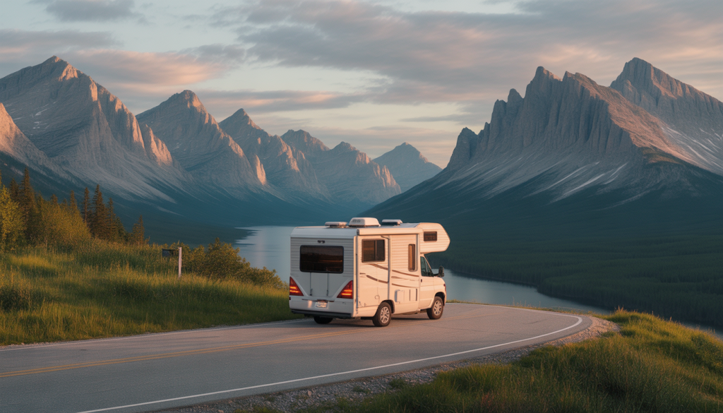
Mastering scenic route planning with elevation maps transforms your RV adventures from mundane highway travel to breathtaking journeys through America’s most stunning landscapes. Elevation maps reveal hidden mountain passes, scenic overlooks, and dramatic terrain changes that standard GPS systems often overlook, allowing you to discover routes that showcase cascading waterfalls, alpine meadows, and panoramic vistas that make for unforgettable memories and spectacular photography opportunities.
Without elevation map planning, RVers frequently miss incredible scenic detours and end up on monotonous interstate highways, unaware that parallel routes just miles away offer jaw-dropping beauty. Understanding topographical information helps you identify scenic byways, historic mountain roads, and elevated viewpoints that provide the kind of awe-inspiring experiences that define exceptional RV travel, turning ordinary trips into extraordinary adventures that showcase the natural magnificence of diverse American landscapes.
📋 Industry Standards & Best Practices
The National Scenic Byways Program and America’s Byways organization recommend using USGS topographical maps with 20-foot contour intervals for detailed scenic route planning, while professional RV tour companies typically utilize elevation data from sources like the National Park Service and Forest Service to identify routes with optimal scenic value. Industry best practices suggest combining multiple elevation mapping resources, including digital terrain models and satellite imagery, to create comprehensive scenic route plans that account for seasonal accessibility, viewpoint locations, and photographic opportunities along elevation changes.
🎯 Product Recommendations
Use USGS topographical maps with 20-foot contour intervals combined with Google Earth’s 3D terrain view to identify scenic ridgelines, valley overlooks, and dramatic elevation changes that indicate potential viewpoints and photogenic landscapes
Plan routes that follow contour lines around mountains and hills rather than straight-line highways, as these naturally scenic paths often reveal hidden waterfalls, rock formations, and panoramic vistas that elevation maps can help you locate
Target elevation gains between 500-2000 feet per scenic segment to maximize dramatic landscape changes and viewpoint opportunities while avoiding overly steep grades that detract from sightseeing
Complete Guide
The problem most RV travelers face is relying solely on standard GPS navigation, which prioritizes speed and distance over scenic value and RV-appropriate grades. This leads to missed opportunities for spectacular drives like the Blue Ridge Parkway’s gentler sections or California’s Pacific Coast Highway, while accidentally ending up on steep mountain passes that stress both your engine and your nerves.
Start your scenic route planning by using elevation mapping tools like USGS topographic maps, hiking apps such as AllTrails, or specialized RV navigation systems that display elevation profiles. These resources show you exactly how much climbing and descending you’ll encounter, allowing you to make informed decisions about timing and preparation. For example, the Going-to-the-Sun Road in Glacier National Park has specific RV restrictions, but nearby routes offer equally stunning views with manageable grades.
When reviewing elevation profiles, look for routes with gradual climbs rather than steep ascents. A good rule of thumb is to avoid sustained grades steeper than 6% when possible, especially if you’re driving a larger Class A motorhome or towing a heavy trailer. However, don’t let moderate grades deter you entirely – some of the most beautiful destinations require a bit of climbing.
Timing becomes crucial when tackling elevation changes. Plan mountain ascents for cooler morning hours when your engine runs more efficiently and you’ll have better visibility for photography stops. Afternoon thunderstorms are common in mountainous areas during summer months, so starting early also helps you avoid weather complications.
Create a backup plan by identifying alternative routes at similar elevations. If your primary scenic route becomes challenging due to weather or mechanical concerns, you’ll have options that don’t require backtracking long distances. Keep a physical road atlas as backup – cell service can be spotty in remote scenic areas where digital maps fail.
Consider breaking longer scenic routes into segments with overnight stops at mid-elevation campgrounds. This approach lets you enjoy the journey without rushing and provides flexibility if weather conditions change. Many scenic byways have strategically located campgrounds that serve as perfect base camps for exploring surrounding areas.
The payoff for proper elevation planning extends beyond safety and convenience. You’ll discover hidden gems like high-altitude lakes, panoramic overlooks, and charming mountain towns that casual travelers often miss. Understanding elevation changes transforms route planning from a necessity into an exciting part of your adventure, helping you create RV travel experiences that rival any luxury vacation.
Step-by-Step Instructions
Step 1
Download topographical mapping apps like Gaia GPS, AllTrails, or CalTopo and input your general destination, then study elevation contours to identify mountain ranges, valleys, and ridgelines that indicate scenic terrain worth exploring
Step 2
Cross-reference elevation maps with official Scenic Byway designations and National Park Service routes, looking for roads that follow natural elevation features like ridge crests, river valleys, and mountain passes
Step 3
Mark potential viewpoints and photo stops by identifying elevation peaks, saddle points, and areas where contour lines indicate dramatic drop-offs or expansive valley views accessible by road
Step 4
Create your final scenic route by connecting identified viewpoints with roads that follow interesting elevation changes, avoiding straight shots across flat terrain in favor of winding paths that showcase topographical variety
💰 Cost Analysis
Initial investment: $50-150 for premium mapping apps (Gaia GPS Pro, OnX Offroad), USGS topographical maps, and guidebooks featuring elevation-based scenic routes
Annual maintenance: $30-60 per year for mapping app subscriptions and updated scenic route guidebooks with current elevation data and road conditions
5 year projection: $200-450 total investment including initial mapping resources, annual app subscriptions, and periodic guidebook updates for comprehensive elevation-based route planning
Cost per year: $40-90 annually when averaged over five years, covering all digital elevation mapping tools and reference materials needed for scenic route discovery
🌍 Regional Considerations
Rocky Mountain regions require elevation maps showing passes above 8,000 feet and seasonal road closures, with routes like Trail Ridge Road and Beartooth Highway demanding specific high-altitude topographical planning
Appalachian Mountain scenic routes focus on elevation maps revealing ridge-running parkways and valley overlooks, with the Blue Ridge Parkway serving as the prime example of elevation-guided scenic route design
Pacific Coast regions use elevation maps to identify clifftop scenic drives and coastal mountain passes, where dramatic elevation changes from sea level to mountain peaks create spectacular oceanview opportunities
🌍 Practical Examples
Using elevation maps to plan the Million Dollar Highway (US 550) in Colorado reveals why this route is scenic—dramatic elevation changes from 7,000 to 11,000 feet showcase alpine peaks, deep canyons, and historic mining towns nestled in mountain valleys
Elevation mapping of Utah’s Scenic Byway 12 shows how following natural contour lines leads to viewpoints overlooking red rock canyons, with topographical analysis revealing optimal stopping points at elevation peaks for panoramic photography
Planning California’s Pacific Coast Highway using elevation maps identifies sections where the road hugs coastal cliffs at various elevations, revealing which segments offer the most dramatic ocean overlooks and coastal mountain vistas
🔍 Common Misconceptions
Many RVers believe scenic routes are only found through online reviews, when elevation maps actually reveal countless undiscovered scenic roads by showing topographical features that indicate natural beauty and dramatic landscapes
Some assume elevation maps are only for hikers, but these tools are invaluable for RV scenic route planning as they reveal the terrain features that create the most spectacular driving experiences and viewpoint opportunities
RVers often think GPS navigation automatically finds scenic routes, but standard GPS prioritizes efficiency over elevation-based scenic value, missing the topographical insights that elevation maps provide for discovering truly spectacular drives
📊 Comparison Analysis
🔧 Tools & Equipment
Topographical mapping applications (Gaia GPS, CalTopo, AllTrails Pro) with offline elevation data capabilities for areas with limited cell coverage
USGS topographical maps or digital terrain models showing 20-foot contour intervals for detailed elevation analysis and scenic route identification
⏱️ Time & Cost Summary
Estimated Time: 2-4 hours of elevation map study per 500-mile scenic route segment, including topographical analysis, viewpoint identification, and cross-referencing with road accessibility data
Estimated Cost: $75-200 initial investment for comprehensive elevation mapping tools and resources, with $30-60 annual costs for app subscriptions and updated materials
📅 Maintenance Schedule
⚠️ Safety Considerations
FAQ
What are elevation maps and why are they essential for scenic RV route planning?
Which apps and tools provide the best elevation maps for planning scenic RV routes?
How do I read elevation profiles on maps to plan the most scenic RV routes?
What elevation changes should I avoid when planning scenic routes with my RV?
How can elevation maps help me find scenic overlooks and viewpoints for my RV trip?
What’s the best way to use elevation maps to plan scenic routes through mountain ranges with an RV?
How do I identify RV-safe scenic routes using elevation gradient information on maps?
Can elevation maps help me plan scenic routes that avoid steep mountain passes unsuitable for RVs?
How do seasonal elevation and weather patterns affect scenic route planning using elevation maps?
What elevation features on maps indicate the most photogenic and scenic viewpoints for RV travelers?
How can I use elevation maps to plan scenic routes with optimal sunrise and sunset viewing locations?
What’s the difference between using topographic elevation maps versus 3D elevation maps for scenic route planning?
How do I combine elevation maps with scenic byway information to create the perfect RV route?
Can elevation maps help me plan scenic loops and circular routes that return to my starting elevation?
How do elevation maps help me estimate travel time and fuel consumption for scenic RV routes?
👨💼 Expert Insights
Professional landscape photographers consistently use elevation maps to identify the most dramatic scenic routes, as topographical features directly correlate with photogenic landscapes and spectacular viewpoints
National Park Service route planners design scenic drives by following natural elevation contours that maximize landscape drama and viewpoint opportunities, a technique RVers can replicate using elevation mapping tools
Experienced RV travelers report that elevation map planning reveals 3-4 times more scenic routes than traditional GPS navigation, particularly in mountainous regions where topographical variety creates the most spectacular driving experiences
📚 Related Topics
- Reading topographical contour lines for RV-accessible scenic viewpoint identification
- Seasonal timing for high-elevation scenic route travel planning
- Photography planning using elevation data to predict sunrise and sunset viewpoints